


Voting District 19, Hughes County, Oklahoma
About
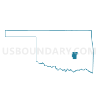
Outline

Summary
| Unique Area Identifier | 654126 |
| Name | Voting District 19 |
| County | Hughes County |
| State | Oklahoma |
| Area (square miles) | 50.95 |
| Land Area (square miles) | 49.99 |
| Water Area (square miles) | 0.96 |
| % of Land Area | 98.11 |
| % of Water Area | 1.89 |
| Latitude of the Internal Point | 34.96870190 |
| Longtitude of the Internal Point | -96.43765740 |
Maps


Graphs
Select a template below for downloading or customizing gragh for Voting District 19, Hughes County, Oklahoma


Neighbors
Neighoring Voting District (by Name) Neighboring Voting District on the Map
- Voting District 12, Hughes County, OK
- Voting District 15, Seminole County, OK
- Voting District 30, Hughes County, OK
- Voting District 35, Hughes County, OK
- Voting District 51, Pontotoc County, OK
Top 10 Neighboring County Subdivision (by Population) Neighboring County Subdivision on the Map
- Holdenville CCD, Hughes County, OK (8,771)
- Wewoka CCD, Seminole County, OK (8,023)
- Northeast Pontotoc CCD, Pontotoc County, OK (5,135)
- South Hughes CCD, Hughes County, OK (2,444)
Top 10 Neighboring Place (by Population) Neighboring Place on the Map
Top 10 Neighboring Unified School District (by Population) Neighboring Unified School District on the Map
- Holdenville Public Schools, OK (7,437)
- Allen Public Schools, OK (2,319)
- Sasakwa Public Schools, OK (1,128)
Top 10 Neighboring State Legislative District Lower Chamber (by Population) Neighboring State Legislative District Lower Chamber on the Map
- State House District 25, OK (36,224)
- State House District 28, OK (35,663)
- State House District 24, OK (35,109)
Top 10 Neighboring State Legislative District Upper Chamber (by Population) Neighboring State Legislative District Upper Chamber on the Map
Top 10 Neighboring 111th Congressional District (by Population) Neighboring 111th Congressional District on the Map
- Congressional District 4, OK (785,424)
- Congressional District 5, OK (749,336)
- Congressional District 2, OK (729,887)
Top 10 Neighboring Census Tract (by Population) Neighboring Census Tract on the Map
- Census Tract 886, Pontotoc County, OK (5,135)
- Census Tract 4847, Hughes County, OK (2,504)
- Census Tract 4850, Hughes County, OK (2,444)
- Census Tract 5839, Seminole County, OK (1,941)